
 Headwaters of the Deschutes at Little Lava Lake on 5/12/19. A dry river.
Without a doubt, current water conditions are dramatically improved from the beginning of the year. All is not well, however, and work to conserve water and improve river flows should remain at the forefront of every angler’s agenda if we hope to continue to enjoy our sport at a high level. As of yesterday, Little Lava Lake is very low, is not spilling into the upper Deschutes, and there is essentially no snow to be seen in that area.
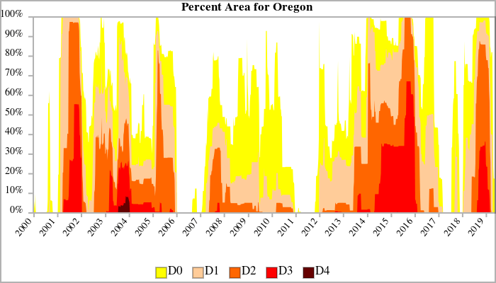
Below is the most recent drought monitor report for Oregon. As you can see, some of the state remains “abnormally dry”, but this is a huge improvement from the beginning of the year when the entire state was abnormally dry, 92% was in moderate drought, 78% was in severe drought, and 23% was in extreme drought. Deschutes County was in severe and extreme drought. It is imperative to understand that drought has become the new normal in Oregon. As the graph below clearly illustrates, large areas of Oregon have been in severe and extreme drought (D2 & D3) for much of the past 20 years.
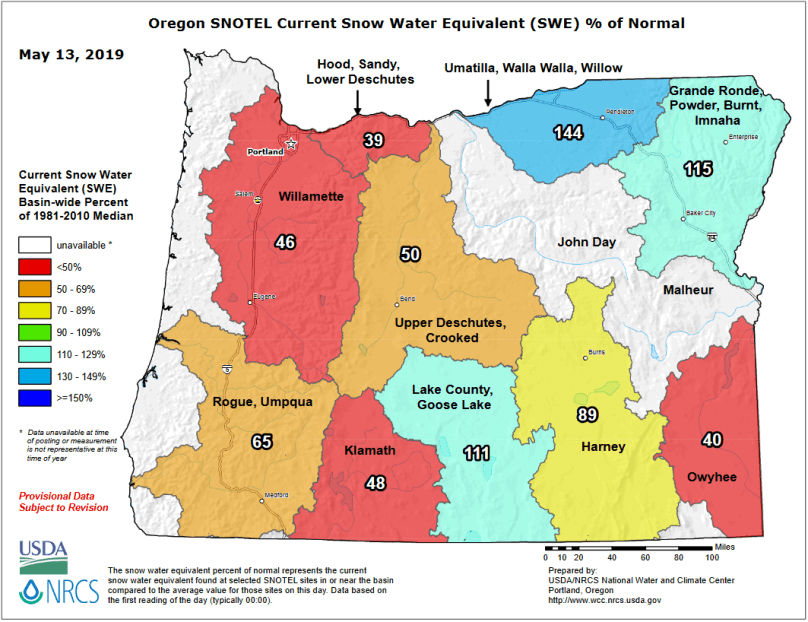
It seems likely that we are already heading into another dry year. The above average snowpack that we were fortunate to receive late in the winter is already below normal for this time of year. As you can see in the chart below, the snowpack in the Deschutes Basin is down to 50% of median as of May 13 (that’s half of normal).
The importance of snowpack cannot be over emphasized. Central Oregon has prospered for the simple reason that it has had a history of heavy snowfall in the Cascades combined with cool weather. If you have lived here for a while you know the complaint about “Juneuary”: June being as cold as January. It lightly snowed on July 4th the year I arrived. Talk to anyone who has lived here for more than 10 years and they will tell you it did not get hot until August and then for only a couple of weeks. Most homes were not air conditioned as it was simply not needed. Our previously cool weather slowly melted abundant snow and slowly released the enormous amount of water stored in the snow over the entire summer.
Global heating is dramatically changing our climate before our eyes if we only take a look. It is creating more extreme weather, like record snowfall in a very short period of time followed by early high temperatures. The average temperate for Bend this time of year is around 60 degrees, it was in the high 80s at my house this weekend, which is above the average high in August and above the 90th percentile for this time of year.
The snowpack is melting much more rapidly than normal and we are likely to return to severe drought conditions over the summer. As you can see below, NOAA is forecasting much higher than normal temperatures for Oregon.

Prineville Reservoir is full, but it is the only local reservoir that has completely filled (see the note below). In the past, these reservoirs would fill and then be replenished throughout the summer as snow melted, sometimes filling as many as two more times. That is not going to happen this year.
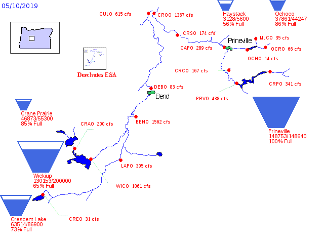
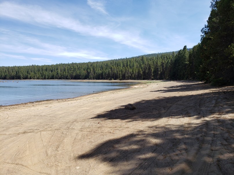
Here’s a photo of Wickiup Reservoir over the weekend. It looks much better than it did last fall, but it the shoreline is far more exposed than normal this time of year. Wickiup could easily be drained dry again this summer from irrigation withdrawals.
Local reservoirs are managed for irrigation flows, not fish and wildlife. The Deschutes and Crooked Rivers are significantly harmed by irrigation practices, practices that are exacerbated in drought conditions. I believe this has to change. Current plans to pipe a few main irrigation canals are completely insufficient. Many, though certainly not all, irrigators have extremely wasteful water usage. This will only change if the public, especially those who use rivers, demand it.
Note: Prineville Reservoir is the only one to fill due to the geology of the Ochoco Mountains which feed the reservoir. They are composed of old, dense lava flows which are largely not permeable. As a result snow melt is mostly surface runoff. The Cascades near Bend are relatively young and extremely porous. Much, though not all, of the snow melts down into the aquifer which feeds springs many miles lower in the basin. It will take more than one year of good snowfall to refill the aquifer to allow it to discharge high in the mountains. This is problematic for Cascade reservoirs and Bridge Creek, Bend’s primary source of drinking water.
