

It’s premature to worry too much about the snowpack and it’s water content, but I think it’s time to start tracking the Natural Resources Water Conservation Service’s monthly water supply outlook report for Oregon. This is a comprehensive report with specific sections on the Upper Deschutes and Crooked River Basins. I’ll provide a few graphics, but I encourage you to at least scan the report. In short, precipitation and snowpack are well below normal for this time of year. As anyone who has lived in Central Oregon for a while knows, it’s foolish to predict the weather around here but we know we need multiple years of above average snow water equivalent to get back to what used to be considered normal.
Here’s the snow water equivalent for the state as of December 31. Remember that SWE is the most important metric to track as it illustrates how much water is stored in snow which will hopefully be slowly released as it melts later in the year.

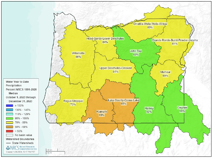
Here’s the water year precipitation for the state. This is also low but illustrates that we are getting more rain than snow, which is not good news. Snow can store far more water than any of our reservoirs or any that we could build.
Of course, this means that many streams and rivers are below normal as well.

