This is yet another in a long string of posts over the years about the lethal mismanagement of the Middle Deschutes by the irrigation districts. I’m tired of this subject and I’m sure readers are as well, but improvement has not occurred and this ongoing ecological disaster needs to be documented. The graph above shows flows in the Middle Deschutes just below the North Canal Dam near the Mt. Washington Drive bridge. The blue line shows flows this water year.
As you can see, extreme, sudden changes in flows are common. On October 13 flows went from 79 cfs to 1,071 on October 16. On November 27 flows went from 467 to 241 on December 4. Extreme changes like this strand fish and generates sediment which chokes spawning beds. Aquatic plants and insects, food for the fish, are impacted as well.
Why there is no public outrage over this, such as is created by the irrigation district operations on the river upstream of Bend, is inexplicable to me. The districts have attempted to be slightly less damaging to aquatic ecosystems in the Upper Deschutes, even staging fish rescues, but give no concern to the Middle Deschutes. Local NGOs are silent as well. (Sigh.)
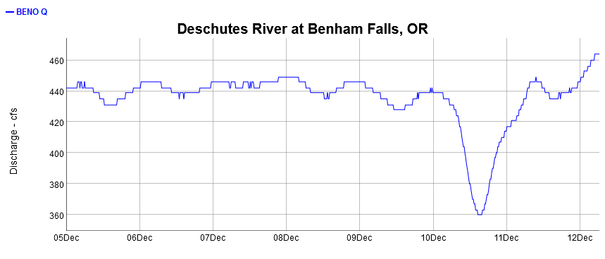
Here’s a daily graph of flows over the past week at Benham Falls. What’s the purpose of the sudden fluctuation?